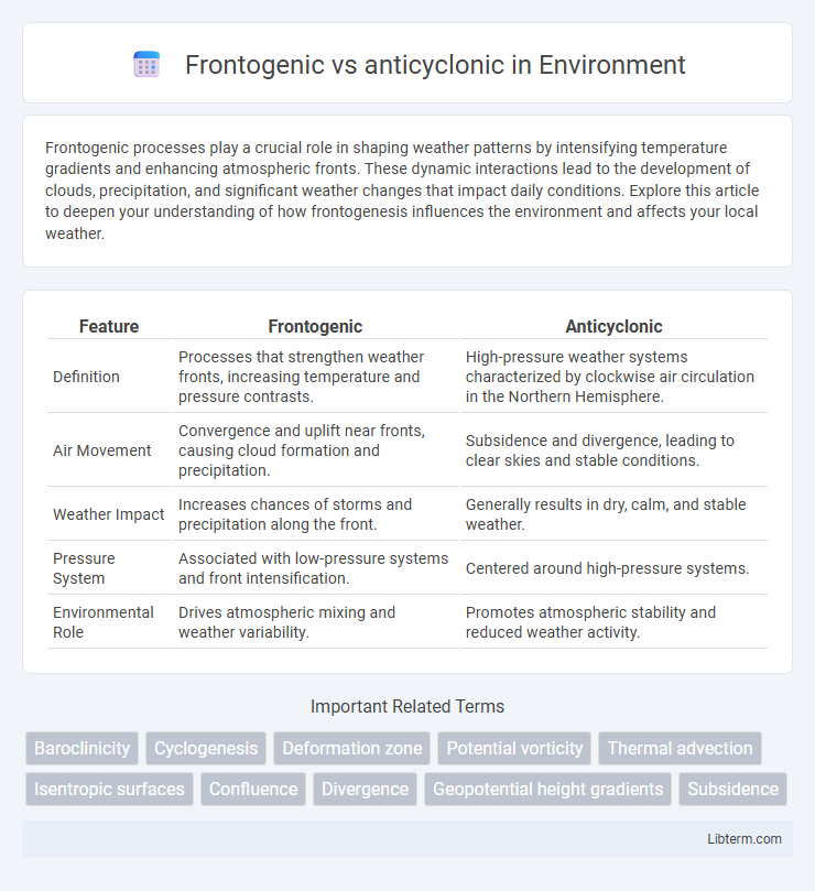
Frontogenic processes play a crucial role in shaping weather patterns by intensifying temperature gradients and enhancing atmospheric fronts. These dynamic interactions lead to the development of clouds, precipitation, and significant weather changes that impact daily conditions. Explore this article to deepen your understanding of how frontogenesis influences the environment and affects your local weather.
Table of Comparison
| Feature | Frontogenic | Anticyclonic |
|---|---|---|
| Definition | Processes that strengthen weather fronts, increasing temperature and pressure contrasts. | High-pressure weather systems characterized by clockwise air circulation in the Northern Hemisphere. |
| Air Movement | Convergence and uplift near fronts, causing cloud formation and precipitation. | Subsidence and divergence, leading to clear skies and stable conditions. |
| Weather Impact | Increases chances of storms and precipitation along the front. | Generally results in dry, calm, and stable weather. |
| Pressure System | Associated with low-pressure systems and front intensification. | Centered around high-pressure systems. |
| Environmental Role | Drives atmospheric mixing and weather variability. | Promotes atmospheric stability and reduced weather activity. |
Introduction to Frontogenesis and Anticyclonic Processes
Frontogenesis describes the formation and intensification of weather fronts where temperature gradients sharpen, leading to distinct boundaries between air masses. Anticyclonic processes involve high-pressure systems characterized by descending air and clockwise circulation in the Northern Hemisphere, promoting stable weather conditions. Both phenomena significantly influence atmospheric dynamics, with frontogenesis driving storm development and anticyclonic processes contributing to clear skies and weather stability.
Defining Frontogenic Systems in Meteorology
Frontogenic systems in meteorology refer to regions where atmospheric conditions promote the formation or intensification of weather fronts due to temperature gradient enhancement and convergence of air masses. These systems contrast with anticyclonic patterns, which are associated with high-pressure areas and generally lead to subsidence and front weakening. Understanding frontogenesis involves analyzing horizontal temperature gradients, wind fields, and deformation deformation rates that contribute to the sharpening of frontal zones.
Understanding Anticyclonic Circulation
Anticyclonic circulation refers to the clockwise rotation of air around a high-pressure system in the Northern Hemisphere, characterized by descending air that suppresses cloud formation and leads to clear, stable weather. This contrasts with frontogenetic processes, which involve the formation or intensification of weather fronts through temperature gradients and convergence zones, promoting dynamic weather changes. Understanding anticyclonic circulation is essential for meteorologists to predict prolonged periods of dry, calm conditions and the influence of high-pressure systems on regional climates.
Key Differences: Frontogenic vs Anticyclonic Phenomena
Frontogenic phenomena involve the intensification of temperature gradients leading to the formation or strengthening of weather fronts, often associated with rising air and precipitation. Anticyclonic phenomena relate to high-pressure systems characterized by sinking air, clear skies, and stable weather conditions. The key difference lies in dynamic processes: frontogenesis enhances temperature contrasts and frontal zones, while anticyclones promote atmospheric stability and divergence at the surface.
Atmospheric Dynamics Behind Frontogenesis
Frontogenesis describes the process of strengthening horizontal temperature gradients, resulting in the formation of a weather front, driven by convergence and deformation in the atmospheric flow. Anticyclonic conditions typically involve subsidence and divergence aloft, which can suppress frontogenesis by reducing the low-level convergence needed to intensify temperature contrasts. The interplay of dynamic variables such as wind shear, vorticity advection, and thermodynamic forcing determines the evolution of frontogenic zones within the broader cyclonic or anticyclonic circulations.
Meteorological Impacts of Anticyclonic Patterns
Anticyclonic patterns generate stable atmospheric conditions characterized by descending air that suppresses cloud formation and precipitation, leading to prolonged dry and clear weather. These weather systems often result in increased temperature inversions, which can trap pollutants near the surface and degrade air quality. Anticyclones also influence wind patterns, promoting calm winds and reducing atmospheric turbulence, thereby affecting local climate and weather predictability.
Weather Patterns Associated with Frontogenic Events
Frontogenic events intensify temperature gradients and often trigger dynamic weather patterns such as heavy precipitation, thunderstorms, and rapid changes in wind direction. These events contrast with anticyclonic conditions, where stable, high-pressure systems typically produce clear skies, calm winds, and dry weather. The interaction between frontogenesis and local atmospheric conditions drives the development of frontal zones, crucial for forecasting severe weather outbreaks.
Effects of Anticyclonic Systems on Climate
Anticyclonic systems, characterized by high-pressure zones and descending air, lead to stable atmospheric conditions with clear skies and reduced precipitation, significantly impacting local climate patterns. These systems often increase temperatures through enhanced solar radiation and contribute to drought conditions by suppressing cloud formation and limiting moisture availability. In contrast to frontogenic zones where air masses converge and cause dynamic weather changes, anticyclones promote prolonged dry and warm episodes influencing regional climate variability.
Case Studies: Frontogenic vs Anticyclonic Events
Case studies reveal that frontogenic events, characterized by the intensification of temperature gradients and the formation of weather fronts, often lead to significant precipitation and storm development, especially in mid-latitude cyclones. In contrast, anticyclonic events, dominated by high-pressure systems and stable atmospheric conditions, usually result in clear skies and reduced precipitation, contributing to prolonged dry spells or heatwaves. Comparative analyses of these phenomena highlight the contrasting impacts on weather patterns, with frontogenic zones driving dynamic meteorological changes while anticyclonic areas promote atmospheric stability and subdued weather activity.
Conclusion: Comparing Implications for Weather Prediction
Frontogenic processes intensify frontal zones by enhancing temperature gradients and moisture contrasts, often leading to increased precipitation and storm development, whereas anticyclonic conditions stabilize the atmosphere, reducing cloud cover and precipitation likelihood. Weather prediction models must account for frontogenesis to accurately forecast severe weather events, while recognizing anticyclonic patterns helps in predicting calmer, clearer conditions. Combining the understanding of both phenomena improves the precision of short-term weather forecasts and hazard assessments.
Frontogenic Infographic

 libterm.com