An isohyet is a line on a map connecting points that receive equal amounts of rainfall during a specific period. Understanding isohyets helps in analyzing precipitation patterns, managing water resources, and planning agricultural activities effectively. Explore the rest of the article to learn how isohyets can impact your environmental and farming decisions.
Table of Comparison
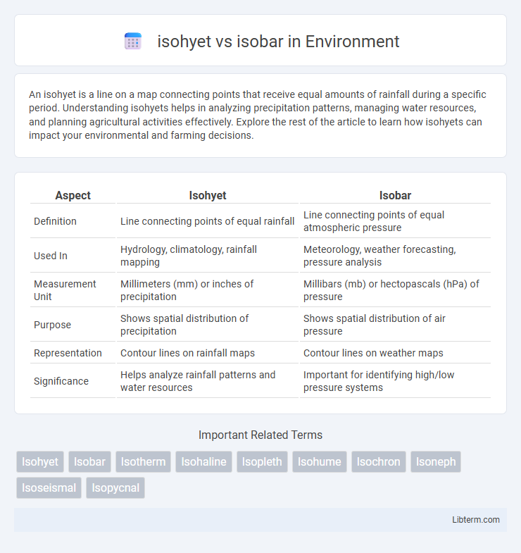
| Aspect | Isohyet | Isobar |
|---|---|---|
| Definition | Line connecting points of equal rainfall | Line connecting points of equal atmospheric pressure |
| Used In | Hydrology, climatology, rainfall mapping | Meteorology, weather forecasting, pressure analysis |
| Measurement Unit | Millimeters (mm) or inches of precipitation | Millibars (mb) or hectopascals (hPa) of pressure |
| Purpose | Shows spatial distribution of precipitation | Shows spatial distribution of air pressure |
| Representation | Contour lines on rainfall maps | Contour lines on weather maps |
| Significance | Helps analyze rainfall patterns and water resources | Important for identifying high/low pressure systems |
Introduction to Isohyet and Isobar
Isohyets are contour lines that connect points of equal precipitation on weather maps, helping meteorologists analyze rainfall distribution and patterns. Isobars are lines that link points of equal atmospheric pressure, crucial for understanding wind flow and predicting weather systems. Both isohyets and isobars play vital roles in meteorological studies by visually representing key atmospheric variables.
Definition of Isohyet
An isohyet is a line on a map connecting points of equal rainfall or precipitation over a specific period, used extensively in meteorology and hydrology to analyze rainfall distribution. In contrast, an isobar represents lines of equal atmospheric pressure, essential for weather forecasting and understanding pressure systems. Understanding isohyets helps in flood prediction, agricultural planning, and water resource management by illustrating spatial variation in rainfall.
Definition of Isobar
Isobar refers to a line on a weather map connecting points of equal atmospheric pressure, which helps meteorologists analyze weather patterns and predict storms. Isohyet represents lines connecting points of equal rainfall, used to assess precipitation distribution. Understanding isobars is essential for interpreting pressure trends and forecasting wind behavior.
Key Differences Between Isohyet and Isobar
Isohyets represent lines of equal rainfall on a weather map, indicating regions with uniform precipitation levels, while isobars connect points of equal atmospheric pressure, highlighting pressure variations essential for weather forecasting. Isohyets are crucial for analyzing spatial distribution of rainfall and its impact on hydrology, whereas isobars help meteorologists determine wind patterns and predict storm systems. The key difference lies in their measured variables: isohyets measure precipitation, and isobars measure atmospheric pressure, serving distinct roles in meteorological analysis.
How Isohyets are Used in Meteorology
Isohyets, lines connecting points of equal precipitation on weather maps, are crucial for analyzing rainfall distribution and intensity in meteorology. These lines help meteorologists identify spatial patterns of rainfall, assess drought conditions, and aid in flood forecasting by illustrating areas with similar precipitation levels. Unlike isobars, which connect points of equal atmospheric pressure, isohyets specifically provide vital data for hydrological studies and climate research focused on precipitation variability.
How Isobars are Used in Weather Analysis
Isobars are lines on weather maps connecting points of equal atmospheric pressure, crucial for identifying high- and low-pressure systems that influence wind and weather patterns. Meteorologists analyze isobar spacing to determine wind speed, with closely spaced isobars indicating stronger winds, aiding in forecasting storms and weather fronts. Unlike isohyets, which map precipitation, isobars provide essential data on pressure gradients that drive atmospheric circulation and weather changes.
Importance of Isohyet Maps
Isohyet maps, which represent lines of equal rainfall, are crucial for hydrological studies, agricultural planning, and water resource management by illustrating spatial precipitation distribution. These maps enable accurate assessment of drought conditions and assist in designing irrigation systems by highlighting rainfall variability. Unlike isobar maps that depict atmospheric pressure, isohyets directly impact environmental and agricultural decision-making through precise precipitation data.
Significance of Isobar Maps
Isobar maps are crucial for meteorologists as they display lines of equal atmospheric pressure, enabling the prediction of weather patterns such as high and low-pressure systems that influence wind speed and direction. These maps are essential for understanding storm development, forecasting rainfall, and tracking cyclones. Unlike isohyet maps that show precipitation distribution, isobar maps provide critical insights into atmospheric dynamics and pressure changes affecting climate conditions.
Visual Representation: Reading Isohyet and Isobar Maps
Isohyet maps visually represent lines connecting points of equal precipitation, aiding in understanding rainfall distribution over an area, while isobar maps display lines of equal atmospheric pressure, crucial for analyzing weather patterns and forecasting. Reading an isohyet map involves identifying zones of varying rainfall intensity by observing closely spaced or widely separated lines, whereas reading an isobar map requires interpreting pressure gradients where tightly packed lines indicate strong winds and potential storms. Both maps use contour lines but differ fundamentally in their meteorological data, making them essential tools for hydrology and weather prediction respectively.
Conclusion: Choosing Between Isohyet and Isobar
Isohyets represent lines of equal precipitation, while isobars denote lines of constant atmospheric pressure, each crucial for different meteorological analyses. Selecting between isohyets and isobars depends on the study's objective: isohyets are essential for hydrological assessments and rainfall distribution mapping, whereas isobars are key for understanding wind patterns and weather forecasting. Accurate interpretation of weather phenomena requires integrating data from both isohyets and isobars to capture comprehensive atmospheric dynamics.
isohyet Infographic