Isotherm refers to a line or curve on a map or diagram representing points of equal temperature, crucial for understanding temperature distribution in meteorology and physics. This concept helps analyze thermal patterns in environments, aiding in weather forecasting and climate studies. Explore the rest of the article to deepen your knowledge on how isotherms influence various scientific fields.
Table of Comparison
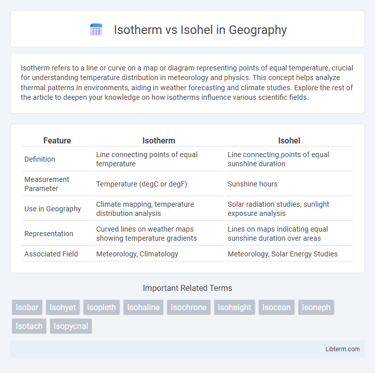
| Feature | Isotherm | Isohel |
|---|---|---|
| Definition | Line connecting points of equal temperature | Line connecting points of equal sunshine duration |
| Measurement Parameter | Temperature (degC or degF) | Sunshine hours |
| Use in Geography | Climate mapping, temperature distribution analysis | Solar radiation studies, sunlight exposure analysis |
| Representation | Curved lines on weather maps showing temperature gradients | Lines on maps indicating equal sunshine duration over areas |
| Associated Field | Meteorology, Climatology | Meteorology, Solar Energy Studies |
Introduction to Isotherm and Isohel
Isotherms are lines on a weather map connecting points of equal temperature, crucial for analyzing temperature distribution and forecasting. Isohels link locations with identical sunshine duration, offering insights into solar radiation patterns and climate studies. Mapping both isotherms and isohels enhances understanding of atmospheric conditions and environmental dynamics.
Defining Isotherm: Meaning and Usage
An isotherm is a line on a map connecting points of equal temperature, used primarily in meteorology and climatology to analyze temperature distribution over a geographic area. It helps in understanding weather patterns, climate zones, and heat flow by visually representing temperature gradients. Unlike isohels, which denote equal hours of sunshine, isotherms focus solely on temperature uniformity across regions.
Understanding Isohel: Explanation and Significance
Isohels represent lines of equal sunshine duration on weather maps, crucial for understanding solar radiation patterns and climate variability. These lines help meteorologists analyze regional sunshine exposure, influencing agricultural productivity and solar energy potential assessments. Mapping isohels provides valuable insights into weather forecasting and environmental planning by revealing areas with consistent sunlight.
Key Differences Between Isotherm and Isohel
Isotherms represent lines connecting points of equal temperature on weather maps, essential for analyzing temperature distribution and climate patterns. Isohels are lines that link locations receiving equal sunlight or solar radiation, crucial for studying solar energy exposure and microclimates. The key difference lies in their measurement focus: isotherms track temperature variations, while isohels map solar irradiation intensity.
Meteorological Applications of Isotherms
Isotherms are lines on a weather map that connect points of equal temperature, playing a crucial role in meteorological analysis by helping to identify temperature gradients and patterns across different regions. They enable meteorologists to predict weather fronts, monitor heat waves, and assess climate variability by visualizing temperature distribution. Unlike isohels that connect points of equal sunshine duration, isotherms provide vital data for forecasting temperature-related atmospheric phenomena.
Meteorological Applications of Isohels
Isohels are contour lines that connect points of equal sunshine duration, playing a critical role in meteorological applications by mapping solar radiation intensity and influencing climate studies and agricultural planning. In contrast, Isotherms represent lines of equal temperature, primarily used to analyze temperature distribution patterns and forecast weather changes. Isohels provide vital data for solar energy potential assessment and help optimize the placement of solar panels and agricultural activities based on sunlight exposure.
Visualization: Interpreting Isotherm and Isohel Maps
Isotherm maps illustrate temperature distribution using contour lines that connect points of equal temperature, enabling clear visualization of thermal gradients and identifying zones of heat variation. Isohel maps depict solar radiation intensity by linking points that receive equal sunlight, facilitating analysis of sun exposure patterns critical for agriculture and urban planning. Both visualization techniques allow meteorologists and geographers to interpret climatic phenomena spatially, enhancing decision-making in environmental and energy-related fields.
Importance in Weather Forecasting
Isotherms represent lines of equal temperature on weather maps, helping meteorologists identify temperature patterns and gradients critical for predicting weather changes. Isohels connect points of equal sunlight intensity, providing essential data on solar radiation that influences temperature variations and atmospheric conditions. Both isotherms and isohels are vital in weather forecasting, as they enable accurate analysis of thermal distribution and solar exposure, improving the precision of climate and weather predictions.
Common Misconceptions About Isotherms and Isohels
Isotherms and isohels are often confused due to their similar names, but isotherms are lines on weather maps connecting points of equal temperature, while isohels connect points receiving equal sunlight. A common misconception is that both represent temperature data, whereas isohels specifically measure solar radiation intensity, important for climate and agricultural studies. Understanding the distinction aids in accurately interpreting meteorological and climatological maps, ensuring proper analysis of temperature patterns versus sunlight distribution.
Conclusion: Choosing the Right Term in Meteorology
Isotherms represent lines on a weather map connecting points of equal temperature, while isohels link locations sharing the same hours of sunshine. Selecting the appropriate term hinges on the meteorological parameter being analyzed--temperature for isotherms and sunshine duration for isohels. Accurate usage enhances data interpretation and communication in climatology and weather forecasting.
Isotherm Infographic