Map grids provide a structured system of intersecting lines that help accurately pinpoint locations on a map, enhancing navigation and spatial understanding. They are essential for hikers, surveyors, and anyone needing precise geographic coordinates. Explore the rest of the article to discover how map grids can improve your navigation skills and make reading maps easier.
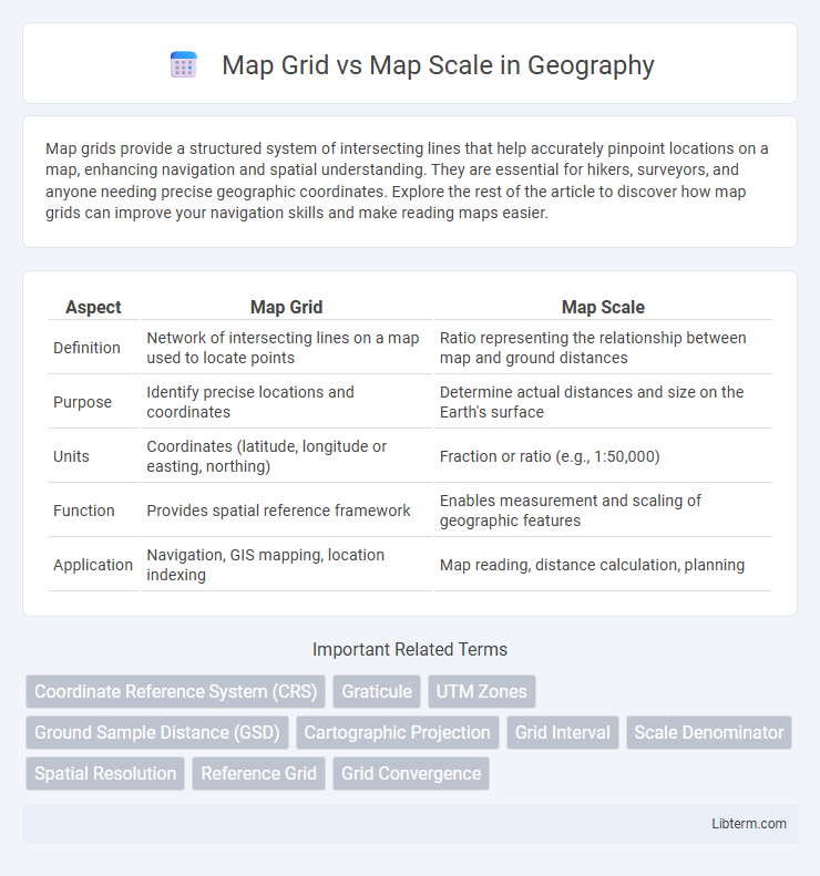
Table of Comparison
| Aspect | Map Grid | Map Scale |
|---|---|---|
| Definition | Network of intersecting lines on a map used to locate points | Ratio representing the relationship between map and ground distances |
| Purpose | Identify precise locations and coordinates | Determine actual distances and size on the Earth's surface |
| Units | Coordinates (latitude, longitude or easting, northing) | Fraction or ratio (e.g., 1:50,000) |
| Function | Provides spatial reference framework | Enables measurement and scaling of geographic features |
| Application | Navigation, GIS mapping, location indexing | Map reading, distance calculation, planning |
Introduction to Map Grid and Map Scale
A map grid is a network of intersecting lines that divides a map into squares or rectangles, facilitating precise location identification through coordinates such as latitude and longitude or UTM (Universal Transverse Mercator). Map scale represents the ratio between a unit of length on the map and the corresponding distance on the ground, typically expressed as a fraction like 1:50,000 or as a graphic scale bar. Understanding both map grids and map scales is essential for accurate navigation, distance measurement, and spatial analysis in cartography and geographic information systems (GIS).
Definitions: What is a Map Grid?
A map grid is a network of intersecting horizontal and vertical lines placed over a map to create a reference system for pinpointing exact locations using coordinates. These grids typically follow latitude and longitude or a universal transverse mercator (UTM) system to divide the map into manageable sections. Map grids enhance spatial accuracy and facilitate navigation, data analysis, and geographic information system (GIS) applications.
Definitions: What is a Map Scale?
A map scale represents the ratio between a distance on the map and the corresponding actual distance on the ground, often expressed as a fraction or verbal statement such as 1:50,000 or "one inch equals one mile." It provides essential information for interpreting spatial relationships, enabling users to measure real-world distances accurately and understand the extent of the mapped area. Unlike a map grid, which divides the map into a reference system of squares for locating features by coordinate, the map scale directly relates to the proportional size and detail of the map itself.
Key Differences Between Map Grid and Map Scale
Map grid refers to the network of intersecting lines, usually latitude and longitude, used to pinpoint exact locations on a map, while map scale represents the ratio between distances on the map and actual distances on the ground. The map grid enables spatial referencing and navigation by providing coordinates, whereas map scale determines the level of detail and area coverage shown, affecting accuracy in distance measurement. Understanding that map grids organize spatial data and map scales control dimensional representation highlights their distinct roles in cartography.
Purpose and Function of Map Grids
Map grids serve as a coordinate system that divides a map into precise, manageable sections to facilitate accurate location referencing and navigation. Unlike map scales that indicate the ratio of a map's distance to real-world distance, map grids enable the systematic identification of specific points using alphanumeric or numeric codes. This function is essential for spatial analysis, emergency response, and geospatial data integration across various mapping applications.
Purpose and Function of Map Scales
Map scales serve the essential function of representing the ratio between distances on the map and the corresponding distances on the ground, allowing users to measure real-world distances accurately. Unlike map grids, which provide a coordinate framework for locating positions, map scales facilitate understanding the extent and detail of geographic features by indicating how much area is covered by a given map segment. Precise map scales are crucial for navigation, planning, and geographic analysis, enabling correct interpretation of spatial relationships and map usability.
Practical Examples: Using Map Grids
Map grids organize spatial data by dividing maps into coordinates, enabling precise location identification for navigation, surveying, and urban planning. For instance, hikers use UTM (Universal Transverse Mercator) grid references to pinpoint trailheads or emergency locations, while city planners rely on grid systems to map infrastructure layouts and zoning boundaries accurately. Contrarily, map scale determines the level of detail and area coverage, essential for understanding distances but less practical for pinpointing exact positions without a grid system.
Practical Examples: Using Map Scales
Map scales provide a practical means to measure real-world distances accurately on a map, such as using a 1:50,000 scale to determine that 1 cm on the map represents 500 meters on the ground, essential for activities like hiking or urban planning. Map grids divide the map into consistent coordinate systems, like the UTM grid, facilitating precise location referencing rather than direct distance measurement. Understanding how to apply map scales in conjunction with grid references enhances navigation and spatial analysis by converting map dimensions into actionable real-world data.
Common Misconceptions About Map Grid vs Map Scale
Common misconceptions about map grid vs map scale often arise from confusing their distinct functions: a map grid provides a coordinate system that helps pinpoint precise locations using alphanumeric or numeric references, whereas map scale indicates the relationship between distances on the map and real-world measurements. Many users mistakenly believe map grids influence the size or level of detail on a map, but scale alone determines the extent of geographic area and detail representation. Understanding that map scale controls the ratio of distance while the map grid enables location referencing is essential for accurate map reading and navigation.
Choosing the Right Tool: Map Grid or Map Scale
Choosing the right tool between map grid and map scale depends on the specific needs of spatial accuracy and measurement. A map grid provides precise location referencing through coordinate systems like UTM or latitude-longitude, essential for navigation and geospatial analysis. In contrast, a map scale translates map distances to real-world measurements, crucial for estimating distances and planning routes effectively.
Map Grid Infographic