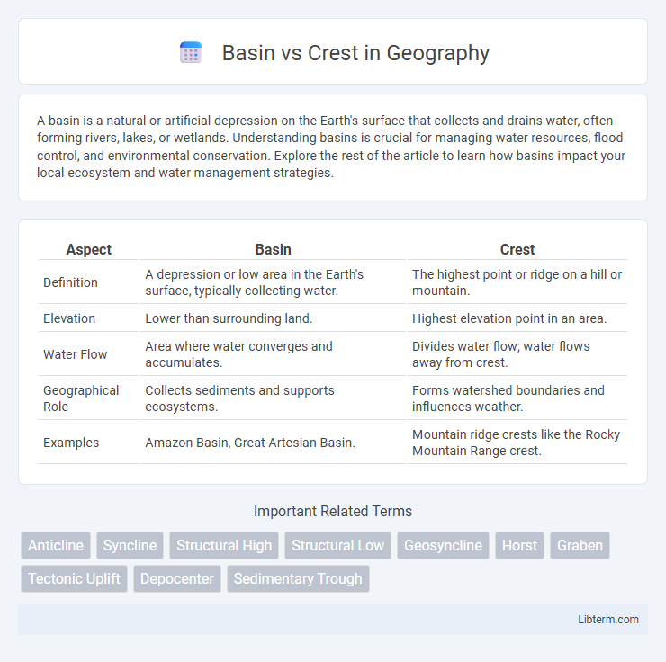
A basin is a natural or artificial depression on the Earth's surface that collects and drains water, often forming rivers, lakes, or wetlands. Understanding basins is crucial for managing water resources, flood control, and environmental conservation. Explore the rest of the article to learn how basins impact your local ecosystem and water management strategies.
Table of Comparison
| Aspect | Basin | Crest |
|---|---|---|
| Definition | A depression or low area in the Earth's surface, typically collecting water. | The highest point or ridge on a hill or mountain. |
| Elevation | Lower than surrounding land. | Highest elevation point in an area. |
| Water Flow | Area where water converges and accumulates. | Divides water flow; water flows away from crest. |
| Geographical Role | Collects sediments and supports ecosystems. | Forms watershed boundaries and influences weather. |
| Examples | Amazon Basin, Great Artesian Basin. | Mountain ridge crests like the Rocky Mountain Range crest. |
Introduction to Basins and Crests
Basins are geological depressions where sediment and water accumulate, often forming fertile lands or bodies of water such as lakes and seas. Crests represent the highest points along ridges or waves, marking peaks in topography or waveform patterns. Understanding basins and crests is essential for fields like geology, hydrology, and signal processing to analyze terrain features or wave behaviors accurately.
Defining Basins: Geology and Features
Basins are geological depressions typically characterized by sediment accumulation and subsidence caused by tectonic activity or erosion. These structural features often exhibit stratified layers of sedimentary rock, supporting rich fossil records and natural resource deposits like oil, gas, and groundwater. Basins contrast with crests, which are elevated geological highs formed by folding or faulting processes.
Understanding Crests: Formation and Types
Crests form at the highest points along the Earth's surface, often marking the peak of ridges or waves caused by tectonic forces or erosion. Different types of crests include mountain crests, which are the highest points along a mountain ridge, and ocean wave crests, characterized by the peak of water waves influenced by wind and gravitational forces. Understanding the formation of crests involves examining processes such as folding, faulting, and sediment deposition, which shape the Earth's topography and influence local ecosystems.
Key Differences Between Basins and Crests
Basins are depressions or low areas in the Earth's surface where sediments accumulate, often forming valleys or sinks, while crests represent the highest points or ridges in landforms such as mountains or hills. Basins typically collect water and sediment, influencing watershed and drainage patterns, whereas crests act as divides directing water flow away from peaks. The structural contrast between basins and crests is essential in geology and topography, affecting erosion, sedimentation, and landscape development.
Geological Processes Shaping Basins and Crests
Basins and crests are shaped by tectonic forces and sedimentary processes that result in distinct topographical features. Basins form through subsidence caused by crustal extension, faulting, or sediment loading, creating depressions that accumulate thick sedimentary layers. In contrast, crests arise from crustal uplift driven by compressional forces, folding, or magmatic intrusions, leading to elevated ridges or mountain ranges.
Basin and Crest Examples Around the World
Basins such as the Amazon Basin in South America and the Congo Basin in Africa are large, low-lying areas that collect water and sediment, supporting diverse ecosystems and agricultural activities. In contrast, crests like the Rocky Mountains in North America and the Himalayas in Asia represent the highest points of mountain ranges, formed by tectonic plate collisions and characterized by steep slopes and rugged terrain. These geographic features influence climate patterns, biodiversity, and human settlement across the globe.
The Role of Basins in Earth’s Water Systems
Basins function as natural reservoirs that collect precipitation, groundwater, and runoff, playing a crucial role in regulating Earth's freshwater supply. They support biodiversity, influence climate patterns, and sustain human activities by managing water flow and storage. Understanding basin dynamics is essential for water resource management, flood control, and maintaining ecological balance.
Ecological Significance of Crests
Crests serve as critical ecological zones by influencing microclimates and supporting diverse plant species adapted to well-drained, exposed conditions. They act as natural barriers affecting water runoff, soil erosion, and nutrient distribution, thereby shaping adjacent basin ecosystems. The unique environmental stressors on crests promote biodiversity hotspots and provide essential habitats for specialized flora and fauna.
Human Activities Impacting Basins and Crests
Human activities such as urbanization, agriculture, and deforestation significantly impact basins by altering natural water flow, increasing runoff, and causing sedimentation that degrades water quality. In contrast, crests or ridges are often affected by mining, construction, and road development, which lead to soil erosion and habitat fragmentation. Both basins and crests experience ecological disturbances that change hydrological cycles and biodiversity patterns.
Summary: Choosing Between Basin and Crest Terminology
Basin refers to a broad, low-lying geological depression that often collects water, while Crest denotes the highest point of a hill or wave. Selecting between basin and crest terminology depends on whether the focus is on the lowest or highest geographical feature within a landscape or structure. Understanding these terms aids in accurate communication in fields like geology, hydrology, and topography.
Basin Infographic

 libterm.com