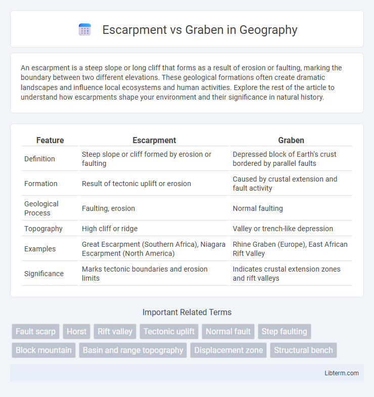
An escarpment is a steep slope or long cliff that forms as a result of erosion or faulting, marking the boundary between two different elevations. These geological formations often create dramatic landscapes and influence local ecosystems and human activities. Explore the rest of the article to understand how escarpments shape your environment and their significance in natural history.
Table of Comparison
| Feature | Escarpment | Graben |
|---|---|---|
| Definition | Steep slope or cliff formed by erosion or faulting | Depressed block of Earth's crust bordered by parallel faults |
| Formation | Result of tectonic uplift or erosion | Caused by crustal extension and fault activity |
| Geological Process | Faulting, erosion | Normal faulting |
| Topography | High cliff or ridge | Valley or trench-like depression |
| Examples | Great Escarpment (Southern Africa), Niagara Escarpment (North America) | Rhine Graben (Europe), East African Rift Valley |
| Significance | Marks tectonic boundaries and erosion limits | Indicates crustal extension zones and rift valleys |
Introduction to Escarpments and Grabens
Escarpments are steep slopes or long cliffs formed by faulting or erosion that separate two relatively level areas of differing elevations, commonly found along tectonic plate boundaries. Grabens are depressed blocks of land bordered by parallel faults, created when the Earth's crust stretches and breaks, causing a section to drop down relative to the surrounding terrain. Both escarpments and grabens are key structural features in rift valleys and are essential to understanding crustal deformation processes.
Geological Definitions: Escarpment vs. Graben
An escarpment is a steep slope or long cliff formed by faulting or erosion that separates two relatively level areas of differing elevations. A graben is a depressed block of the Earth's crust bordered by parallel normal faults, resulting in a down-dropped landform between uplifted blocks. Both features arise from tectonic processes but differ in structure: escarpments emphasize sharp elevation changes while grabens represent subsided crustal segments.
Formation Processes of Escarpments
Escarpments form primarily through tectonic activities such as faulting, where a block of the Earth's crust is displaced vertically, creating a steep slope or cliff. They also develop via erosional processes that selectively remove softer rock layers while leaving harder strata exposed as a raised edge. The uplift and tilting of landmasses during orogenic events contribute to the pronounced elevation differences characteristic of escarpments.
How Grabens Are Created
Grabens are created through tectonic forces that cause the Earth's crust to stretch and thin, leading to the formation of fault lines where blocks of land drop down between two parallel normal faults. This process results in a sunken block of land bordered by higher escarpments or fault scarps. The extensional environment responsible for graben formation contrasts with the typically uplifted and tilted cliffs seen in escarpments.
Key Differences Between Escarpments and Grabens
Escarpments are steep slopes or long cliffs formed by faulting or erosion, often marking a sharp elevation change between two land surfaces. Grabens are depressed blocks of the Earth's crust bordered by parallel faults, resulting in a lowered land area relative to surrounding terrain. The key difference lies in escarpments representing the vertical face or boundary, while grabens represent the sunken block or valley formed between faults.
Notable Examples Around the World
The East African Rift Valley is a prominent example of a graben, characterized by depressed blocks of the Earth's crust bordered by faults, stretching from the Afar Triangle in Ethiopia to Mozambique. The Niagara Escarpment in North America showcases a classic escarpment, formed by resistant rock layers that create steep cliffs and significant elevation changes across Ontario and Michigan. The Rhine Valley in Europe illustrates the graben structure, while the famous Great Escarpment in southern Africa extends over 5,000 kilometers, representing a major geological feature with dramatic cliffs formed by faulting and erosion.
Ecological Impacts of Escarpments and Grabens
Escarpments create unique microclimates and diverse habitats due to their steep slopes and elevation changes, fostering high biodiversity and serving as natural barriers for species migration. Grabens, characterized by subsided land between faults, often form valleys that accumulate water, supporting wetlands and distinct aquatic ecosystems vital for numerous flora and fauna. Both geological features influence soil distribution and hydrology, shaping ecological niches and impacting local vegetation patterns and wildlife corridors.
Human Activities and Their Influence
Escarpments often guide urban development and transportation routes due to their steep slopes and clear natural boundaries, while grabens, characterized by sunken blocks between faults, frequently contain fertile valleys suitable for agriculture. Human mining activities frequently target escarpments for mineral extraction, altering natural landscapes and affecting erosion patterns. In grabens, water accumulation and sedimentation influenced by human irrigation and land use intensify soil fertility but can also increase flood risks.
Importance in Earth Sciences and Geology
Escarpments and grabens are critical geological features that reveal insights into tectonic processes and crustal deformation. Escarpments, characterized by steep slopes formed by faulting or erosion, mark significant vertical displacements and help interpret seismic activity and landscape evolution. Grabens, as sunken blocks bordered by parallel faults, provide essential evidence for extensional tectonics and basin formation, crucial for understanding continental rifting and sedimentary basin development.
Future Research and Exploration Directions
Future research on escarpments and grabens should prioritize high-resolution geophysical imaging and drone-based topographic mapping to uncover detailed fault dynamics. Integrating machine learning with seismic and satellite data will enhance the prediction of tectonic activity and surface deformation patterns. Exploration efforts aimed at these geological structures can improve resource identification and hazard assessment in tectonically active regions.
Escarpment Infographic

 libterm.com