Isogonic lines are geographic lines on a map that connect points of equal magnetic declination, showing the angle difference between magnetic north and true north. Understanding these lines is crucial for accurate navigation and compass correction, especially for pilots and mariners. Explore the rest of the article to learn how isogonic lines impact your navigational decisions.
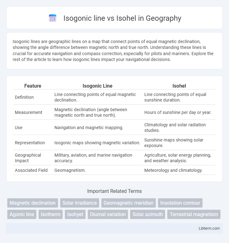
Table of Comparison
| Feature | Isogonic Line | Isohel |
|---|---|---|
| Definition | Line connecting points of equal magnetic declination. | Line connecting points of equal sunshine duration. |
| Measurement | Magnetic declination (angle between magnetic north and true north). | Hours of sunshine per day or year. |
| Use | Navigation and magnetic mapping. | Climatology and solar radiation studies. |
| Representation | Isogonic maps showing magnetic variation. | Sunshine maps showing solar exposure. |
| Geographical Impact | Military, aviation, and marine navigation accuracy. | Agriculture, solar energy planning, and weather analysis. |
| Associated Field | Geomagnetism. | Meteorology and climatology. |
Introduction to Isogonic Lines and Isohels
Isogonic lines represent geographic contours connecting points of equal magnetic declination, essential for accurate navigation and compass corrections. Isohels are lines on a map that link locations receiving the same amount of sunshine, critical for climatology and solar energy studies. Both isogonic lines and isohels provide valuable insights into Earth's magnetic field variations and solar radiation distribution, aiding scientific research and practical applications.
Defining Isogonic Lines
Isogonic lines are geographic lines on a map connecting points where the magnetic declination is the same, representing equal angular differences between true north and magnetic north. Unlike isohels, which map equal sunshine duration or solar exposure, isogonic lines specifically relate to Earth's geomagnetic field and assist in navigation and compass calibration. Understanding isogonic lines is essential for accurate navigation and correcting compass errors caused by variations in magnetic declination across different regions.
Defining Isohels
Isohels are lines on a map that connect points receiving equal hours of sunlight during a day, essential in solar radiation and climatology studies. Unlike isogonic lines, which indicate constant magnetic declination relative to true north, isohels directly measure solar exposure and help analyze sunlight duration patterns. These solar contour lines assist in optimizing solar panel placement and understanding regional daylight variations.
Formation of Isogonic Lines
Isogonic lines are contours on maps representing points of equal magnetic declination, formed due to variations in the Earth's magnetic field caused by the differing concentrations of magnetic minerals in the Earth's crust. These lines result from the complex interactions between the geomagnetic field and regional geological structures, causing the compass needle to deviate from true north by a constant angle along each line. In contrast, isohels denote lines of equal sunlight duration, unrelated to magnetic properties, and are shaped by Earth's axial tilt and orbital dynamics.
Formation and Significance of Isohels
Isohels are lines on weather maps that connect points receiving equal solar radiation, formed due to variations in sunlight intensity caused by factors such as cloud cover, atmospheric particles, and the angle of the sun. Their formation is influenced primarily by the duration and angle of solar exposure, which affects solar energy distribution on Earth's surface. Isohels are significant for understanding patterns in solar radiation, aiding in agricultural planning, solar energy harvesting, and climate studies, distinguishing them from isogonic lines that represent magnetic declination variations.
Key Differences Between Isogonic Lines and Isohels
Isogonic lines represent locations on Earth's surface where the magnetic declination is constant, showing the angle difference between magnetic north and true north, whereas isohels depict areas receiving equal sunlight duration. The key difference lies in their applications: isogonic lines are critical for navigation and compass correction, while isohels assist in solar energy studies and climate research. Isogonic lines are measured in degrees of angular deviation, whereas isohels are characterized by specific hours or minutes of sunshine.
Applications of Isogonic Lines in Navigation
Isogonic lines represent lines of equal magnetic declination, crucial in navigational charting to correct compass readings and ensure accurate course plotting. Mariners and aviators utilize isogonic lines to adjust for the angular difference between magnetic north and true north, enhancing directional precision in diverse geographical regions. Integrating isogonic line data into navigation systems improves safety and efficiency by minimizing heading errors caused by magnetic variations.
Uses of Isohels in Meteorology
Isohels are contour lines that connect points with equal sunshine duration, used in meteorology to analyze solar radiation patterns and their effects on climate and weather forecasting. Isogonic lines, which link locations of equal magnetic declination, are primarily applied in navigation and geomagnetic studies. By mapping isohels, meteorologists can assess regional solar energy availability, influencing agricultural planning and solar power installation site selection.
Mapping and Visualization Techniques
Isogonic lines represent the geographic contours of equal magnetic declination, essential for compass correction in navigation maps, while isohels depict areas of equal sunshine duration, crucial for solar radiation studies. Mapping isogonic lines involves interpolating geomagnetic data from magnetic observatories and satellites, enhanced by digital elevation models to improve accuracy in complex terrains. Isohel visualization relies on solar radiation models integrated with meteorological data, often rendered through GIS platforms for detailed temporal and spatial analysis of sunlight exposure.
Conclusion: Understanding Isogonic Lines vs Isohels
Isogonic lines represent geographic contours where the magnetic declination remains constant, critical for accurate compass navigation. Isohels map areas with equal sunshine duration, essential for climatology and solar energy studies. Distinguishing between these lines enhances precision in geospatial analysis, supporting navigation accuracy and environmental assessments.
Isogonic line Infographic