Erosion is the natural process where soil, rock, and sediment are worn away and transported by wind, water, or ice. Understanding how erosion impacts landscapes and human activities is crucial for effective environmental management and conservation. Discover how erosion affects your surroundings and what measures can be taken to prevent its damaging effects by reading the full article.
Table of Comparison
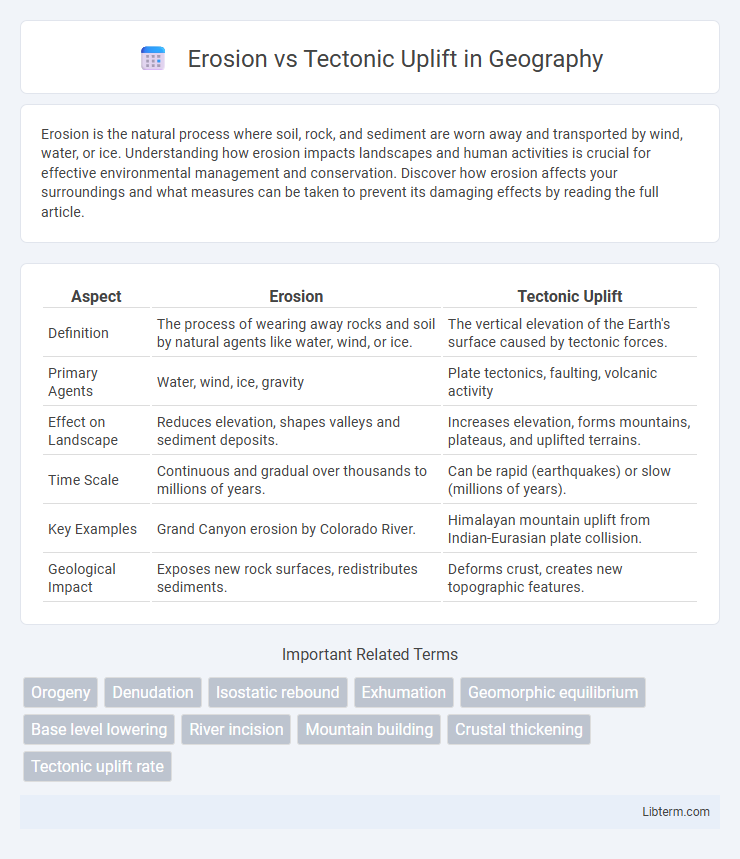
| Aspect | Erosion | Tectonic Uplift |
|---|---|---|
| Definition | The process of wearing away rocks and soil by natural agents like water, wind, or ice. | The vertical elevation of the Earth's surface caused by tectonic forces. |
| Primary Agents | Water, wind, ice, gravity | Plate tectonics, faulting, volcanic activity |
| Effect on Landscape | Reduces elevation, shapes valleys and sediment deposits. | Increases elevation, forms mountains, plateaus, and uplifted terrains. |
| Time Scale | Continuous and gradual over thousands to millions of years. | Can be rapid (earthquakes) or slow (millions of years). |
| Key Examples | Grand Canyon erosion by Colorado River. | Himalayan mountain uplift from Indian-Eurasian plate collision. |
| Geological Impact | Exposes new rock surfaces, redistributes sediments. | Deforms crust, creates new topographic features. |
Introduction to Erosion and Tectonic Uplift
Erosion is the process by which natural forces like water, wind, and ice wear away rocks and soil, reshaping Earth's surface over time. Tectonic uplift involves the vertical elevation of the Earth's crust due to tectonic forces such as plate movements and volcanic activity. These contrasting geological processes continuously interact, influencing landscape formation and the Earth's topographical evolution.
Defining Erosion: Processes and Types
Erosion is the natural process that breaks down and removes soil, rock, and other surface materials through agents such as water, wind, ice, and gravity. Key types of erosion include water erosion, which shapes river valleys and coastal landscapes; wind erosion, common in arid regions and deserts; glacial erosion, which carves mountains and fjords; and mass wasting, involving the downhill movement of debris due to gravity. Understanding these processes is vital for analyzing how erosion counteracts tectonic uplift by redistributing sediments and reshaping Earth's crust.
Understanding Tectonic Uplift: Mechanisms and Causes
Tectonic uplift occurs when Earth's crust is forced upward due to tectonic plate interactions such as collision, subduction, or mantle plumes. This geological process results from compressional forces that thicken the crust, leading to the formation of mountain ranges and elevated terrains. Understanding mechanisms like isostasy and faulting reveals how tectonic uplift shapes landscapes, counteracting erosion over millions of years.
Major Differences Between Erosion and Tectonic Uplift
Erosion involves the removal and transportation of surface materials by natural forces such as water, wind, or ice, leading to the gradual wearing down of landscapes over time. In contrast, tectonic uplift refers to the geological process where Earth's crust is pushed upward due to tectonic plate movements, resulting in the elevation of landforms like mountains and plateaus. While erosion reshapes the Earth's surface by breaking down and redistributing materials, tectonic uplift builds and elevates landmasses through internal Earth dynamics.
Interactions: How Erosion and Uplift Shape Landscapes
Erosion and tectonic uplift interact dynamically to sculpt landscapes by continuously removing surface material while elevating landmasses, which exposes fresh rock to further weathering. The balance between uplift rates and erosion intensity dictates the formation of features such as mountain ranges, valleys, and plateaus, with faster uplift creating rugged terrain and dominant erosion smoothing relief over geologic time. These opposing forces drive the evolution of topography, influencing sediment transport and ecosystem distribution across tectonically active regions.
Geological Examples: Case Studies Around the World
Erosion and tectonic uplift shape Earth's surface through contrasting processes; erosion removes material via water, wind, or ice, while tectonic uplift raises land through plate movements. The Himalayas exemplify tectonic uplift where the Indian Plate collides with the Eurasian Plate, creating some of the world's tallest peaks, while the Grand Canyon in the United States showcases erosion's power as the Colorado River carved deep through sedimentary rock layers over millions of years. Similarly, the Andes in South America highlight active uplift along the subduction zones of the Nazca and South American Plates, whereas the Badlands in South Dakota reveal intense erosion sculpting rugged landscapes from rapidly eroding sedimentary rocks.
Impact on Ecosystems and Human Activities
Erosion and tectonic uplift significantly influence ecosystems by reshaping habitats and altering soil composition and water availability, which affects biodiversity and vegetation patterns. Human activities such as agriculture, urban development, and infrastructure construction are impacted by these processes due to changing landforms and increased risk of natural hazards like landslides and floods. Understanding the balance between erosion rates and uplift helps in managing land use sustainably and mitigating environmental and economic risks.
Measuring and Monitoring Erosion vs Tectonic Uplift
Measuring and monitoring erosion and tectonic uplift involve utilizing remote sensing technologies such as LiDAR and satellite imagery to capture topographic changes over time. Geodetic methods like GPS and InSAR provide precise data on vertical land movements, distinguishing between surface material loss from erosion and elevation gains from tectonic activity. Combining sediment yield analysis with uplift rate measurements enables accurate assessment of landscape evolution and geodynamic processes.
Current Research and Advances in Geoscience
Recent research in geoscience leverages high-resolution satellite imagery and advanced geochronology techniques to quantify rates of erosion and tectonic uplift with unprecedented precision. Studies using cosmogenic nuclide dating reveal complex interactions between surface processes and tectonics, showing how erosion can both drive and respond to uplift in active orogenic belts. Numerical models integrating seismic data and landscape evolution simulations provide insights into feedback mechanisms that control mountain building and landscape resilience over geological timescales.
Conclusion: Balancing Forces in Earth’s Surface Evolution
Erosion and tectonic uplift act as competing forces shaping Earth's surface, with uplift creating new landforms by raising terrain and erosion wearing them down over time. The dynamic equilibrium between these processes regulates landscape elevation, influencing sediment transport and watershed development. Understanding this balance is critical for predicting geological changes and managing natural hazards in evolving environments.
Erosion Infographic